Posted
Five Top Vernon Trails for Epic Views
Posted:
#ExploreVernon #ExploreBC #VernonBC
Get out and explore Vernon's trails for high altitude views of beautiful vistas, local history and culture.
When Ingrid Neumann donated a bench to be placed at the top of Middleton Mountain in Vernon, she chose a very fitting caption for the engraving: “Life is like a mountain: Challenging to climb at times, but worth the amazing views along the way.”
Neumann is with the Ribbons of Green Trails Society, a non-profit, trail advocacy group dedicated to the promotion and construction of walking, hiking and cycling trails, both on and off-road within the Greater Vernon region. They invited me out to experience some of Vernon’s trail networks and our excursion ended up being a combination of three of my favourite things: walking outdoors, hearing about local history, and learning something new about a place I thought I knew already.
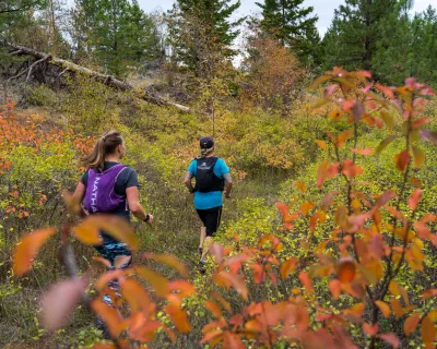
Middleton Mountain Trails at Farnsworth Nature Reserve
Rating: Difficult
Distance: 3.4 kilometres long with an elevation gain of 142 metres
Ingrid was having a really proud “if you build it, they will come” Field of Dreams moment every time a new individual, jogger, or couple climbed the steps and took a walk around Middleton Mountain. She was instrumental in the planning of this trail, and securing all 90 acres of protected land thanks to the Farnsworth family's strong desire to leave their 50 acre portion to be enjoyed by all. Working with the Regional District of the North Okanagan and Ribbons of Green, Ingrid’s vision - years in the making - came to life when the Farnsworth Nature Reserve at Middleton Mountain opened in 2015.
She was thrilled to see so many people taking advantage of the trails. It looked to me like folks did this every morning - like the Grouse Grind of Vernon, but with just a few stairs (to warrant the difficult rating) then a nice smooth incline/decline at the top.
This grassland hill (it’s not actually a mountain) is where Indigenous plant species and wildlife thrive. Bees buzzing around yellow twig rabbitbrush, colourful arrowleaf balsamroot, boxes on posts ready to house mountain bluebirds, marmots, meadowlarks, and quail. Watch out for prickly pear cactus among the grass, which is always a good reminder to stay on the designated path. Read interpretive signs along the way to learn more about the wildlife from the North Okanagan Naturalists’ Club.
HIKE VERNON FOR UNPARALLELED BEAUTY.
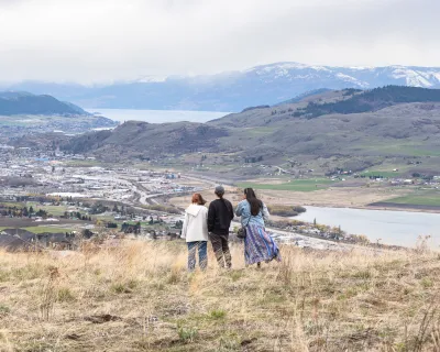
Middleton Mountain was the perfect way to start the day. At its many 360-degree viewpoints, Ingrid could point out every single other trail we were going to walk that day, from the Coldstream Valley to Turtle Mountain and beyond.
One common thread was the Grey Canal. This extensive infrastructure network of ditches, canals, pipes and trestles was completed in 1914 with the goal of moving water from lakes on the highlands southeast of Vernon to Okanagan Lake. It was a vital part of providing irrigation to ranchlands and orchards. At one time, it supplied water to the largest irrigation district in BC. Out of commission since 1970, you can still see its route from Middleton, then you can head to the actual paths beside this massive water-moving network all around the city.

Photo:
Rebecca Bollwitt
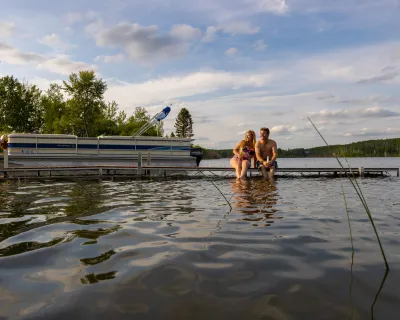
Descending Middleton Mountain with a view of Kalamalka Lake.
Grey Canal: Bella Vista / Okanagan Hills
Rating: Easy
Distance: 3.5km
Bella Vista sure does live up to its name, although there are no bad views along these trails. Follow the wide, packed-gravel path and head west with Middleton Mountain and Kalamalka Lake as landmarks behind you and to the left, and Okanagan Lake and the historic Davidson Orchard ahead. Here you can really see some old Grey Canal remnants including box drains and connections where water from the canal would head down furrows to the orchard below. The path acts like a border between the arid grassland and the lush apple orchards and pumpkin patches below. You can see how the irrigation was needed, and was really effective.
GET ON THE TRAILS FOR YOUR FIX OF VERNON VIBES.
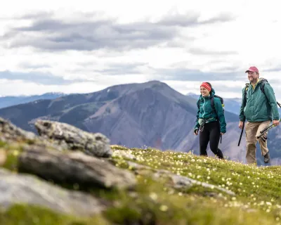
Grey Canal: Turtle Mountain
Rating: Moderate
Distance: 3.5km
Heading east along the rocky-cliffside boardwalk with Middleton Mountain in the distance on your right from the Turtle Mountain trailhead, this trail really shows off the geology of the region. A portion of the former Grey Canal’s Knight Siphon, a big steel pipe, can still be seen poking up under the gravel path. More great views are to be had here, including Swan Lake and Silverstar Mountain. There are a few steep sections, up and down, but they’re very short and worth the trek.

Photo:
Rebecca Bollwitt
Hiking along the Grey Canal Trail.
Grey Canal: Swan Lake East
Rating: Difficult
Distance: 1.1km
This is where to find fall colours and spring wildflowers. Tucked up on the hillside above Swan Lake, this 1.1km out-and-back trail has a lush kissing canopy, bright yellow aspens, apple trees, little boardwalks over creeks and several different pieces of the Grey Canal. We bordered backyard farms and grazing cattle ranches along the trail until we found an old trestle with curved sheets of metal that used to carry the canal water. It was like a treasure hunt every time we came across a different piece of the canal puzzle.
Just as the Grey Canal was built in the spirit of connecting water sources with farms, the Grey Canal Trail will one day connect dozens of neighbourhoods, cyclists, walkers, and joggers across its 50km path.
“There are eight hikeable sections of the Grey Canal, with three holes where there is still private land,” says Ingrid. With her enthusiasm and determination, along with the support of RIbbons of Green Trails Society and the North Okanagan Regional District, the hope is to fully connect the network, like Vernon’s own mini Trans Canada Trail.
EXPLORE VERNON'S EXPANDING TRAIL NETWORK.
Polson Greenway Multi-Use Path (MUP)
Rating: Easy
Distance: Variable (path network)
If you want to connect between Grey Canal Trail segments, take the MUP! This paved, separated path is your connection to everything - including more trails. It goes right through Vernon along 30th Street. To the south, it meets up with the Kal Lake Road Multi-Use Path around Kal Beach, which is also right near the Okanagan Rail Trail. Heading north, it traverses downtown Vernon from Polson Park north to the Village Green Mall. If you’re shopping or enjoying one of Vernon’s many delicious eateries, this is your way to get there, too.

Photo:
Rebecca Bollwitt
WHEN YOU GO
Find More Trails
The Ribbons of Green Trails Society has created a really helpful Trail Map of the Greater Vernon Area that you can click and sort by difficulty, get directions, and more. There are some great descriptions and history included thanks to Ingrid and her team.
Trail Etiquette
To help educate new trail users and remind experienced hikers, the Ribbons of Green Society offers some helpful tips for making the best of your visit.
- Mind your pets. Ensure dogs are allowed on the trail. Keep dogs on a short leash and pick up after them.
- Stay right – pass left. When meeting oncoming hikers on the trail, continue on the right side, single-file, leaving half the trail space. Ensure children and pets remain on right side of trail.
- When passing a hiker from behind, call out with a friendly ‘hello’ to pass on their left side. Cyclists may ring their bell or call out “On your Left!” to warn they will be passing.
- Standing still? Step aside. Make room for oncoming hikers.
- Respect private property and farmlands. Please do not trespass.
- Stay on trail. Respect the environment and leave it as you found it. Keep dogs on-leash and on-trail to avoid cacti and spreading weed seeds.
- Use waste receptacles or carry out your trash. Leave no trace on the trail.
- Respect wildlife. Keep a safe distance. Don’t feed wildlife and keep your dog under control.
- Right of way. Individual hiker, move to the side for larger groups.
- Downhill hikers yield to those going uphill.
- Cyclists yield to hikers.
- Hikers and cyclists yield to horse riders.